The current snowpack in the central Sierra is over 230% of normal and steadily increasing. Simply put, we are about to reach record snowpack levels and are not nearly through our Miracle March or our April Showers. Much more is yet to come, including the potential for spectacular waterfalls and massive flooding. This record-setting winter will set the stage for late seasonal openings this summer and the potential for some extreme conditions, such as snow and river crossings, especially in the backcountry. In this post, we will give our best predictions for the 2023 Yosemite summer season, focusing on the key areas of the park. We will consider the current snowpack levels, historical information such as Yosemite’s Historical Seasonal Opening & Closing Dates, and our personal experiences over the past 28 years.
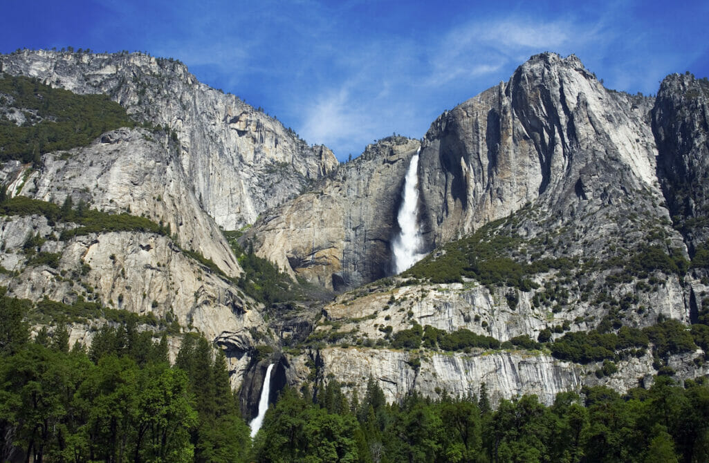
Yosemite Valley – 4,000 feet in elevation
The iconic and scenic Yosemite Valley is open year-round unless forced to close by weather or other naturally occurring events. The Valley is the most popular and visited area of Yosemite. This season’s waterfalls will be insane, and visitation will be very high to witness them firsthand between April-June. There are many day hikes around the Valley, some that originate from the Valley floor and rise rapidly, such as the very popular Mist Trail/Nevada Fall Loop or the Yosemite Falls hike. The latter is usually available, at-least to some extent, year-round due to its southern exposure. We don’t expect the famous Half Dome in a Day hike to be open with cables in place until after the first or second week of June. Some backpacking trails also originate in the Valley, allowing you to reach some outstanding overnight locations between 6000-7500′ where snow should be present but lessened by later May and throughout June. One of our favorites includes Yosemite’s North Rim on our Yosemite Icons trip and the Southern Rim of the Valley via the Pohono Trail by Tunnel View. Note: The way this spring plays out, there will be many opportunities for Yosemite Valley to flood. If severe they will be forced to close the eastern section of the Yosemite valley only. Pending nothing significant, expect daily swelling around the rivers/streams regularly every afternoon/evening in late May-early July, especially on those hot days with increased snowmelt. This flooding and/or daily swelling of the rivers/streams in the Yosemite Valley will also decrease the amount of usable campsites in the Yosemite Valley Backpackers Campground (which is already impacted due to the Tuolumne Meadows Campground closure). However use may be decreased when backpackers realize they need to ford a “river” to get to the campsite area.
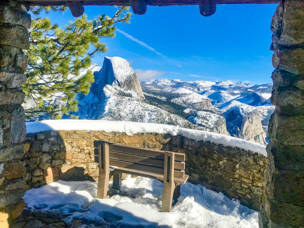
Glacier Point – 7214 feet in elevation
Glacier Point is one of the most visited tourist locations within Yosemite National Park due to its panoramic high sierra viewpoint that can be driven to. This road typically opens well before Tioga Rd does and prior to Memorial Day weekend. Such was the case in 2011 and 2017 when we had 178% snowpack, and Glacier Point opened on May 27th and May 11th, respectively. However, the one variable in 2023 other than the weather that may play a significant issue on the opening date would be the Glacier Point Road Project, the road rehabilitation project which closed the road entirely in 2022 and which is supposed to be ongoing with delays throughout 2023. Yosemite has now released more information stating that once the Glacier Point road is finally cleared from snow, that construction work still needs to occur and that they do not anticipate opening the road to traffic until at least July. This does mean that prior to the road opening, should you be interested in hiking up to Glacier Point via either the 4-mile Trail or Panorama Trail; you will be awarded with those magnificent views w/o the typical large crowds at Glacier Point. This will be a bucket-list hike in late May and through June for sure. Once opened, our favorite day hikes from this area include Glacier Point down the Panorama and Mist Trail and Sentinel Dome and Taft Point from Glacier Point. One of our favorite backpacking trips is the Glacier Point to Half Dome trip, which is safer to consider after July 1st due to the unknown opening of the cables to Half Dome and/or the Glacier Point Road itself. Stay tuned!
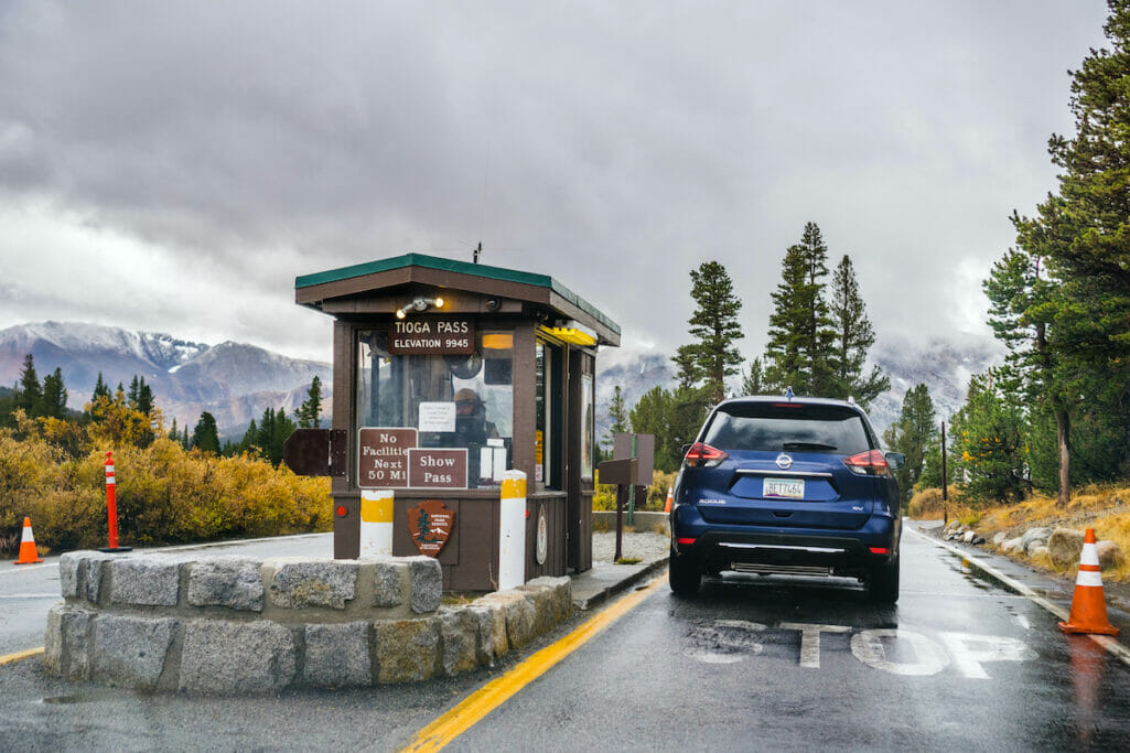
Tioga Road and Tuolumne Meadows – 8600-9945 feet in elevation
Tioga Road is the highest road across the Sierra Nevada that, on a typical snowpack season, opens by Memorial Day weekend. The Tioga Road is also the gateway to the Eastern Sierra, and many local economies depend on its opening. Based on the historical data and the winter we are currently experiencing, it is safe to say that Tioga Rd. will not open until at least July 1st. This late opening means that many of the most sought-after backpacking trailheads in Yosemite will not be unavailable until then. Once Tioga Road opens and because of its popularity, expect most trails to be blazed within a couple of weeks. However, expect snow and frozen lakes above 9000′ for most of July and into at-least early August. Snow should remain present in the higher north-facing elevations of approximately 9,500′ and above throughout the summer. Once Tioga Road opens, partaking in a Tuolumne Meadows Day Hike is a great way to explore the general vicinity. Clouds Rest or Mt. Hoffman day hikes offer an excellent summit experience. (Expect snow and even water crossings throughout August.) Backpacking from Tioga Road and Tuolumne Meadows provides many great options, including Amazing Sunsets, ideal for families. Our 6-day Tuolumne Meadows to Half Dome trip is excellent for families with older kids or friends. Both trips should be outstanding in mid-July-September. Remember the Grand Canyon of the Tuolumne to see some less often viewed waterfalls returning to full life this season.
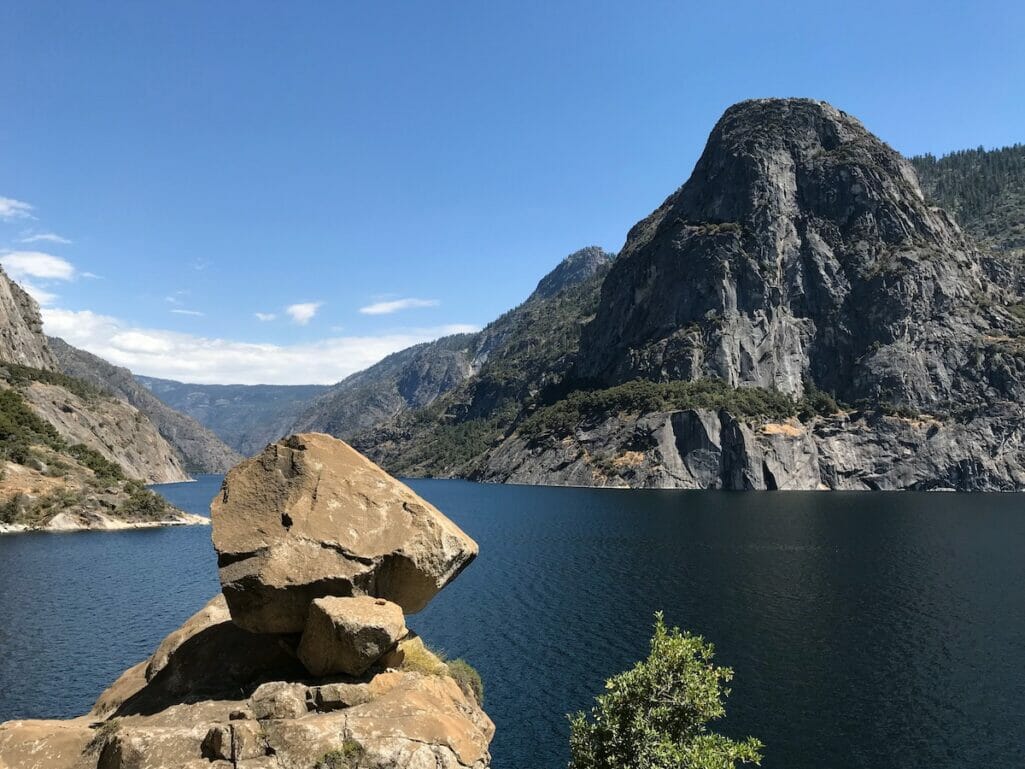
Hetch Hetchy – 3900 feet in elevation
Hetch Hetchy has one of the longest hiking seasons in Yosemite and is a great place for early-season hikes and viewing waterfalls and wildflowers in the spring. With other areas of the park inaccessible, Hetch Hetchy offers a great way to experience waterfalls without the Yosemite Valley crowds. Check out the Hetch Hetchy and Wapama Falls Day Hike. There are also some good early-season backpacking opportunities to Laurel Lake, Rancheria Falls, Tiltill Valley, and Lake Vernon, all between 4000-6900′. (Be careful on the Frog Creek crossing!) We will also use this area for many May/June backpacking trips, including family trips and our youth Summer Camp programs.
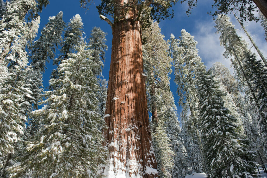
Wawona and the Mariposa Grove of Big Trees – 3999 and 5600 feet in elevation
Wawona is in southern Yosemite and halfway between Yosemite Valley and the park’s southern gate along Hwy 41. Open year-round, Wawona is home to the Yosemite History Center, Chilnualna Falls, and near the Mariposa Grove of Giant Sequoias, the largest sequoia grove in Yosemite. The hikes around Wawona and Mariposa Grove are accessible year-round, yet conditions should be good to enjoy these areas mid to later April.
Please note that predicting weather in California during a warming trend is not easy. The predictions above are based on the current snowpack only. The weather between now and any specific summer trip date in Yosemite can significantly affect the conditions.
When is the best season to visit? It depends on what you’re coming to see. If seeing waterfalls in their most total capacities is your goal, then April-June are the months to go. Suppose you want to visit when more of Yosemite is open, including Tuolumne Meadows and Tioga Road, then anything aftermid July. The crowds are worst between July 4th and the first week of August. Late August through September, the masses calm, waterfalls trickle, mosquitos die, the temps cool, and the trails should all be accessible. This part of the season is our favorite to visit the backcountry.
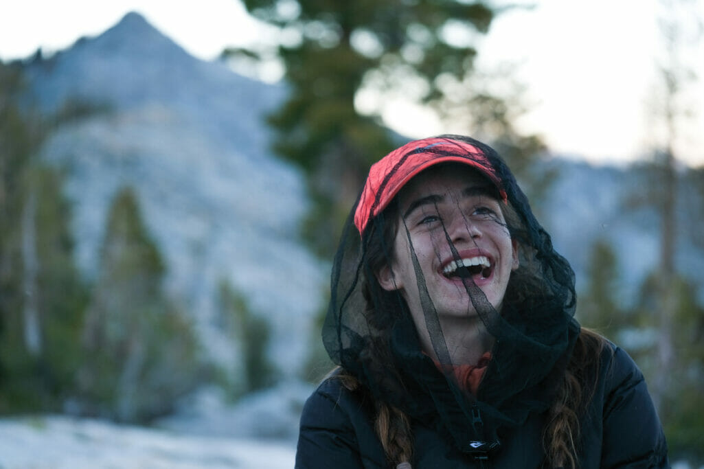
Other expectations and gear suggestions: Walking along the trails as they wind through meadows and up and over passes coming alive from the snow is an experience to be noticed. Be prepared for wet and muddy trails while walking along, besides, and over snow. Also be ready for stream/river crossings and the possibility of some bridges being damaged. (Best to always check the Trails and Wilderness Conditions prior to your adventure.) Yet, also be prepared for ephemeral streams, lush meadows, snow-covered summits, giant waterfalls, and fast-flowing rivers. Backcountry camping throughout the early season will be in dried-out areas among the snow, with snow within the vicinity, or sometimes even on snow. Expect warm days and cold nights, with mosquitoes being an ongoing issue until after the snow has fully melted. Essential gear will include waterproof shoes or boots, trekking poles, sandals with back straps (for river crossings), base layers, a warm hat, mittens, and extra socks. A mosquito head net is essential and an added sense of adventure for experiencing these magical conditions. Please Note: Our Equipment Lists are comprehensive of any/all conditions we might enconuter. We will also be supplying trekking poles on all trips and snowspikes and/or snowshoes when needed.
WARNING: : The high water level and fast flowing current will be the greatest concern of any this year. River and stream crossings will be dangerous. Many bridges will be washed out and/or non-existent. Plan ahead and gain the most updated trail information including anticipated creek/river crossings. Your planned itinerary will be affected this season in some capacity, and the major concern will be safe water crossings.
Summer Camps
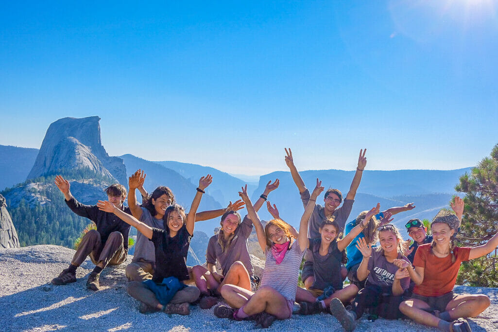
Throughout June and into July as needed, our Yosemite Summer Camps will be based at lower elevations accessed from the Yosemite Valley, the Glacier Point Road, or relocated to areas above Hetch Hetchy reservoir. Most all summer camps scheduled to meet/end at Curry Village in Yosemite Valley will still be doing so. Through June, expect most all 6-Day Yosemite High Country Adventure programs to be relocated to a meeting location either in Yosemite Valley or at Hetch Hetchy Reservoir. Updated meeting locations will be communicated in advanced camp emails and based on the most updated conditions as well as permit availability. In addition to the expectations above, be prepared for added adventure as you experience Yosemite in unparalleled beauty as it comes to life after one of the wettest winter seasons on record.
FLOODING
WARNING: Yosemite has issued a warning that, “There may be some periods between late April and early July when Yosemite Valley is inaccessible due to flooding.” Yosemite has issued this warning that they will close the eastern side of Yosemite Valley if there is a potential for the Merced River to reach flood stage. They expect this can happen on and off and based on increased temperatures through most of June. This happened on the weekend of April 28-30th, yet the river never reached flood stage and they reopened the closed area days earlier then expected. As long as we have a gradual warm-up this spring, this will be a non issue. However if the Yosemite Valley does close preemptively on a date you were either scheduled for a day hike or meeting for a backpacking trip or summer camp; we will have a back-up meeting location planned and communicated to you in advance or as soon as posisble. Please note that this closure of the eastern side of Yosemite Valley is often communciated on the news as a “Yosemite closure” when it is only a smaller sction of the Yosemite Valley. Yosemite is almost 1200 square miles and offers many areas to explore and hike that wont be affected by Yosmeite Valley preemptive flooding closures.
Yosemite Reservations – Will they return for 2023?
Despite huge anticipated crowds, Yosemite National Park is signaling that reservations will NOT be in place this year while they continue to research alternatives for and around the reservation process. What this means to you? Yosemite will be VERY crowded all summer long. This crowding will be intensified prior to July when both the Glacier Point Road and Tioga Road open. The majority of people visiting the park at this time will all be headed to Yosemite Valley. (In 2011, after a snowpack of 178% it took over 2.5 hours to travel from Bridalveil Fall to Curry Village in Yosemite Valley; only about 5-miles. In 2019 prior to resevrations, wait-time at entrance gates was regularly over 1.5-2 hours long.) If planning a trip to Yosemite, we suggest you start each day early with plans to be parked and hiking by 8:30-9am if not earlier. In this fashion you will beat the traffic/crowds, find parking, and embark on the trails ahead of the incoming masses.
WARNING: Yosemite has issued a warning that, “There may be some periods between late April and early July when Yosemite Valley is inaccessible due to flooding.” Check conditions prior to traveling. If scheduled on a trip with us, we will contact you accordingly.
PREDICTED OPENING DATES:
Glacier Point Road Opening: The park is signaling that this road will not be open for traffic until at-least July.
Half Dome Opening (Cables in-place): First to second week of June
Tioga Road Opening: Will not open until at least July 1st.
Reservations Returning for the 2023 summer? No, so plan your days in Yosemite to start early unless you like to sit in traffic and view things from your windows.
For more up-to-date information, see:
